Atlas/GPS Consensus
Topic 31145 | Page 2
Chris P; in seven years of experience, I’ve never bought a “truck GPS.” While I support those who use them, I just think; if it’s going to be a financially significant purchase, it’s less necessary for a company driver than some other items.
I hope this helps.
HOS:
Hours Of Service
HOS refers to the logbook hours of service regulations.Like Steve I started in 2015. The first thing I bought for my truck when I got back into trucking this year was the Rand McNally atlas (couldn’t find my old one). I ended up later buying a truck gps (I got the Garmin Dezl OTR 700 and freaking love it) for the sake of convenience and it has yet to steer me wrong in any major way but I always check the route before I leave. I don’t usually cross reference with the atlas anymore but I’ll still give the route a look over to make sure it looks right. One thing all GPS’s tend to do which you gotta watch out for is to route you around construction or what it thinks is a non truck route when in reality there’s nothing wrong with going straight through. For example last night on my way to the Home Depot I’m delivering to, the gps wanted me to veer off the main road right outside the store and go like a block off route and then go back to the main road because there was one block that was supposedly not a truck route. I checked it out on Google maps satellite beforehand (these are local roads so 99% of the time the atlas won’t have any info for it anyway) and watched signs when I got there and the road was fine. Like everyone else said, the truck gps and Google maps and atlas are all tools and you’ll have the most success learning to use all three and knowing the limitations of each one. These days I don’t really look at the atlas very often but I wouldn’t want to roll down the road without one. I may not use it much these days (I also do regional so I drive the same roads a lot) but the atlas has the final say for any route I want to take. If I’m not sure about the way the gps is taking me or if I’m wondering if I can take a different way I check the atlas. Like others said, you gotta be vigilant about watching road signs, especially on local roads where gps and maps don’t really help as much for trucks.
Regional:
Regional Route
Usually refers to a driver hauling freight within one particular region of the country. You might be in the "Southeast Regional Division" or "Midwest Regional". Regional route drivers often get home on the weekends which is one of the main appeals for this type of route.
OTR:
Over The Road
OTR driving normally means you'll be hauling freight to various customers throughout your company's hauling region. It often entails being gone from home for two to three weeks at a time.
OWI:
Operating While Intoxicated
My CDL instructor was driving while I was sleeping. I woke to a really tough "road". We were in PA and he followed the GPS down a smaller road which ended in the middle of a corn field.
One newbie I know followed a GPS down a road that after 2 miles became a driveway. When she did a U Turn she took out 2 cars and rant over a fence, getting stuck in a muddy garden. Again in PA. The owner came out screaming the whole time and threatened her with a rifle.
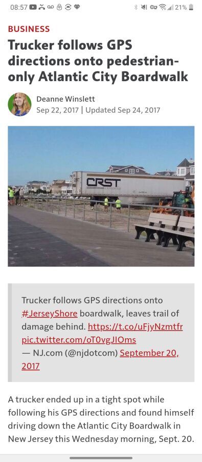
I myself was in Elizabeth NJ and was indeed on a truck routes, until a sign read "End Truck Route". No where to turn around it all. No warehouses, it just ended with an 11 foot pedestrian walk away on front of me. I called the cops on myself so they could stop traffic and turn me around. In Chicago, many bridges on non truck routes are not marked. Trucks shouldn't be there so why bother? BOOM! There is a low bridge in southern jersey on US 130 where I have watched trucks go BOOM my whole life. The GPS still routes there. Even with the inputted dimensions.
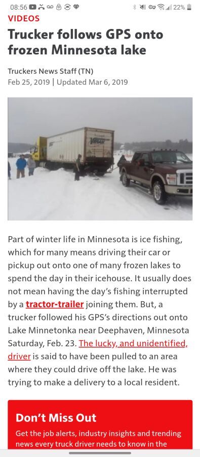
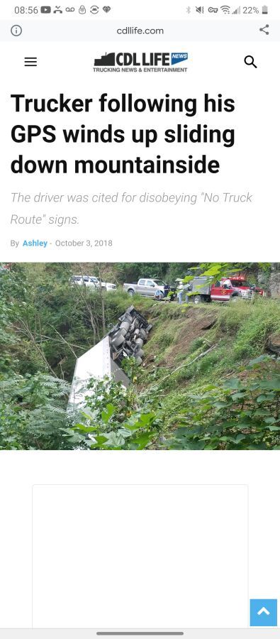
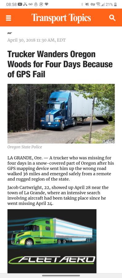
My first year driving, 3 trucks wound up on the same PA lake.. It was dark and raining on each of those nights and the road went down a hill then became a boat slip. 2 trucks were totaled. Google "Trucker Uses GPS" and you will see horror stories... The more recent ones are a couple years old.... But ALL GPS have a disclaimer stating this is a recommendation only...
CDL:
Commercial Driver's License (CDL)
A CDL is required to drive any of the following vehicles:
- Any combination of vehicles with a gross combined weight rating (GCWR) of 26,001 or more pounds, providing the gross vehicle weight rating (GVWR) of the vehicle being towed is in excess of 10,000 pounds.
- Any single vehicle with a GVWR of 26,001 or more pounds, or any such vehicle towing another not in excess of 10,000 pounds.
- Any vehicle, regardless of size, designed to transport 16 or more persons, including the driver.
- Any vehicle required by federal regulations to be placarded while transporting hazardous materials.
HOS:
Hours Of Service
HOS refers to the logbook hours of service regulations.I use a combination of Rand McNally truck GPS and Google maps. I compare the routes before starting out. More often than not Google will show a faster/lower mileage route. If I look a little closer at the Google route it's usually a little shorter bc it will take you down some smaller roads that take a more direct path to your destination, but might not be a good idea for trucks to take.
I primarily follow the truck gps. I still refer to Google as I near my destination bc the overhead view allows me to see the layout of the yard I'm going to. It shows me exactly where I need to turn into the customer's yard (some customers are notorious for their lack of signage).
Regardless of what you use the key is not blindly following anything without checking it out first (not bad life advice either lol). No matter what you use you’re most likely going to find yourself on a road you shouldn’t be in at some point in your career. If that happens, STOP and don’t be afraid to call the police to help you out if you need to. I’ve done it and I bet most of the experienced drivers here have done it too.
OWI:
Operating While Intoxicated
I remember w Stevens my Qualcomm directions actually had Bakersfield flip/flopped. It was actually hilarious because my co-driver did not believe me. The lot lizard infested truck stop was right smack in the middle. That was his reference point for Bakersfield. I used Motor Carriers Atlas only. Of course 15 years has passed and GPS are getting better "Blind faith in your gadgets can get you killed"
Qualcomm:
Omnitracs (a.k.a. Qualcomm) is a satellite-based messaging system with built-in GPS capabilities built by Qualcomm. It has a small computer screen and keyboard and is tied into the truck’s computer. It allows trucking companies to track where the driver is at, monitor the truck, and send and receive messages with the driver – similar to email.Don't Make The 6 O'clock News!
Don't Make The 6 O'clock News!
Funny you mention that. I had a coworker make the news while I was training. It made them a little harder on us, but I get it. You can see it Here
You can see it Here
12'8"!! Do they not teach measurements in school anymore?? How could he not know that his 13' 6" height was taller than 12 ft 8 inch?
Laura
New Reply:
New! Check out our help videos for a better understanding of our forum features


Preview:
This topic has the following tags:
Becoming A Truck Driver GPS Systems Hard Lessons Learned Hours Of Service Logbook Questions Trip Planning



 TT On Facebook
I use my Garmin Dezl 780 for cross country navigation. I use my Omnitracs Navigo for last 10-20 miles as it has been hand programed in some instances for the specific customer location. Both GPS systems do absolutely get it wrong, and often.
I use my company provided last mile directions to understand the specific routes they want us to take near the customer, and the overhead Google Maps satellite photos to get an idea of what the customer location and surrounding area looks like.
I also subscribe to TruckerPath and pat for their truck GPS plan, but only use it for route planning and to find stops along the way.
My Rand McNally motor carrier atlas is an invaluable reference on the rare case that I need it. But when I need it, I'm very grateful I followed the advice of many here and bought one.
GPS should be updated often and the atlas should be replaced at least every 2 years.